| IMAGE |
IMAGE NO.
|
DATA
|
| Station |
|
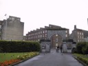
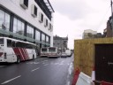
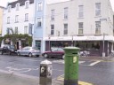
Limerick Station (both for trains and buses), Parnell St. |
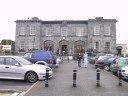 |
lim2005-001
|
(Thursday 4 August) Limerick Station (both for trains and buses), Parnell St. |
| |
|
|
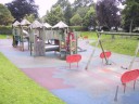
| People's Park |
|
People's Park, etc. |
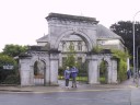 |
lim2005-002
|
(Thursday 4 August) The front gate of People's Park, viewed from Perry Square |
 |
lim2005-003
|
(Thursday 4 August) People's Park |
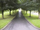 |
lim2005-004
|
(Thursday 4 August) People's Park |
 |
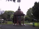
lim2005-005
|
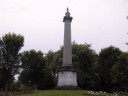
(Thursday 4 August) Monument of Thomas Spring M.P.( 1820-1832), People's Park |
 |
lim2005-007
|
(Thursday 4 August) Monument of Thomas Spring M.P.( 1820-1832), People's Park |
 |
lim2005-008
|
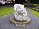
(Thursday 4 August) A commemorative stone, People's Park |
 |
lim2005-009
|
(Thursday 4 August) People's Park |
 |
lim2005-010
|
(Thursday 4 August) People's Park |
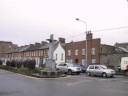 |
lim2005-011
|
(Thursday 4 August) Perry Square |
 |
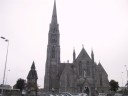
lim2005-012
|
(Thursday 4 August) Dominican Church, Glentworth Street |
| |
|
|
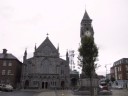
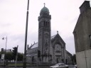
| St. John Cathedral |
|
St. John Cathedral, John Square |
 |
lim2005-013
|
(Thursday 4 August) St. John Cathedral, John Sq. |
 |
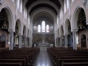
lim2005-014
|
(Thursday 4 August) Interior of St. John Cathedral, John Sq. |
 |
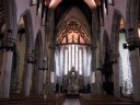
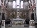
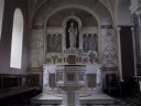
lim2005-016
|
(Thursday 4 August) Interior of St. John Cathedral, John Sq. |
 |
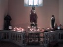
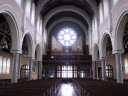
lim2005-017
|
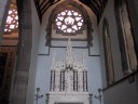
(Thursday 4 August) Interior of St. John Cathedral, John Sq. |
 |
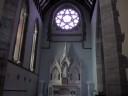
lim2005-018
|
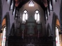
(Thursday 4 August) Interior of St. John Cathedral, John Sq. |
 |
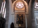
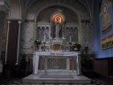
lim2005-019
|
(Thursday 4 August) Interior of St. John Cathedral, John Sq. |
 |
lim2005-020
|
(Thursday 4 August) Interior of St. John Cathedral, John Sq. |
| |
|
|
| Irish Town |
|
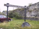
Irish Town City Wall Park |
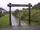 |
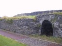
lim2005-021
|
(Thursday 4 August) Irishtown City Wall Park, established 1997: the remains of the 9th-century Viking castle town |
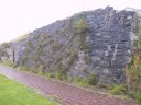 |
lim2005-022
|
(Thursday 4 August) Irishtown City Wall Park, established 1997: the remains of the 9th-century Viking castle town |
 |
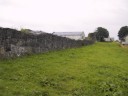
lim2005-023
|
(Thursday 4 August) Irishtown City Wall Park, established 1997: the remains of the 9th-century Viking castle town |
 |
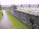
lim2005-024
|
(Thursday 4 August) Irishtown City Wall Park, established 1997: the remains of the 9th-century Viking castle town |
 |
lim2005-025
|
(Thursday 4 August) Irishtown City Wall Park, established 1997: the remains of the 9th-century Viking castle town |
 |
lim2005-026
|
(Thursday 4 August) Irishtown City Wall Park, established 1997: the remains of the 9th-century Viking castle town |
| |
|
|
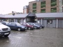
| Milk Market |
|
Milk Market, Com Market Row |
 |
lim2005-028
|
(Thursday 4 August) Milk Market, Com Market Row |
 |
lim2005-029
|
(Thursday 4 August) Milk Market, Com Market Row |
 |
lim2005-030
|
(Thursday 4 August) Milk Market, Com Market Row |
| |
|
|
| East Side |
|
East Side of the Shannon River |
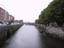 |
lim2005-031
|
(Thursday 4 August) A canal towards River Shannon through Charlottes Quay and Georges Quay |
 |
lim2005-032
|
(Thursday 4 August) A church, Athlunkard St. |
 |
lim2005-033
|
(Thursday 4 August) Interior of the church, Athlunkard St. |
 |
lim2005-034
|
(Thursday 4 August) Interior of the church, Athlunkard St. |
 |
lim2005-035
|
(Thursday 4 August) Interior of the church, Athlunkard St. |
 |
lim2005-036
|
(Thursday 4 August) Interior of the church, Athlunkard St. |
 |
lim2005-037
|
(Thursday 4 August) Interior of the church, Athlunkard St. |
 |
lim2005-039
|
(Thursday 4 August) Interior of the church, Athlunkard St. |
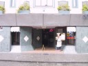 |
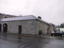
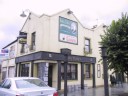
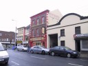
lim2005-047
|
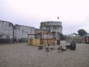
(Thursday 4 August) Stix Reisure Centre and Restaurant, Nicholas St., near King John's Castle |
 |
lim2005-048
|
(Thursday 4 August) Nicholas St. near King John's Castle |
 |
lim2005-049
|
(Thursday 4 August) "Katy Daly's," a bar & restaurant, Nicholas St., near King John's Castle |
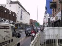 |
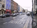
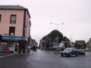
lim2005-061
|
(Thursday 4 August) Sarsfield Street, viewed from Sarsfield Bridge |
 |
lim2005-062
|
(Thursday 4 August) Bedford Row, viewed from Harvey's Quay |
 |
lim2005-063
|
(Thursday 4 August) Harvey's Quay |
 |
lim2005-064
|
(Thursday 4 August) Shannon Street, viewed from Harvey's Quay |
 |
lim2005-065
|
(Thursday 4 August) O'Connell Street, viewed from Shannon Street |
 |
lim2005-066
|
(Thursday 4 August) O'Connell Street, viewed from Shannon Street |
 |
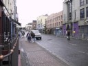
lim2005-067
|
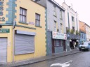
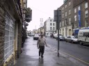
(Thursday 4 August) Catherine Street |
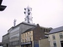 |
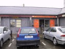
lim2005-068
|
(Thursday 4 August) Telephone Bureau, Roches Street |
 |
lim2005-069
|
(Thursday 4 August) Roches Street |
 |
lim2005-070
|
(Thursday 4 August) Wickham Street |
| |
|
|
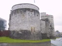
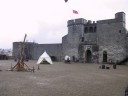
| King John's Castle |
|
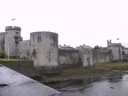
King John's Castle, Nicholas St.
Although now known as King John's Castle, in fact the castle's origins can be traced back to the reign of John's father, Henry II. The Anglo-Norman invasion of Ireland, spearheaded by Richard de Clare FitzGilbert ("Strongbow"), which commenced in 1169, was characterized by the seizure of the wealthy port towns, beginning with Dublin and Waterford, and the rapid acquisition of the most desirable tracts pf land. The town of Limerick was already well established by Viking settlers in the 11th century, and by 1169 was thriving commercial centre with its own town wall, and a large population of Ostman citizens (of mixed Irish and Viking race).
The inspiration behind the construction of the permanent castle at Limerick was King John, who was given the title Lord of Ireland in 1177 by his father, Henry II. In 1199, John succeeded to the throne on the death of his brother, Richard. King John established a number of royal castles including Dublin Castle in Ireland but he sis not issue a similar order at Limerick, as a fortification already existed there, but during his reign Limerick Castle was enlarged and made a royal possession. The castle of Limerick at the time of King John's death in 1216 was very different to the one we see today.
Limerick Castle reached the apex of its development in the Middle Ages during the reign of King John's grand son, King Edward I (1272-1307). However, a great deal was accomplished by Edward's father, Henry III (1216-1272).
The most traumatic episode in the history of the castle was ushered in during May and June 1642, and was a consequence of the spreading rebellion sparked off in Ulster in October 1641. The lives of 280 people were claimed during this time, from a total of around 800 souls in the castle, many of whom were buried in the courtyard when the siege was still in progress. Again, in 1651 the city was captured by the parliamentarian army led by Henry Ireton, following a grueling six-month siege. the accession of James II, a Catholic, in 1685, had far-reaching consequences in Limerick. The Catholic population became predominant, and when James landed in Ireland in 1689, to win his crown back from William III, limerick, including the castle, was secure for him. Following the surrender of the city after the siege of 1691, further repairs were made to the castle. Its north side still bears traces of the 1691 bombardment.
The 18th century was relatively settled in comparison to the upheavals of the period between 1642 and 1691. In 1809 Colonel Charles Vereker, later 2nd Viscount Gort, became the last constable of Limerick Castle. In May 1922, the British military finally withdrew from the castle, when custody passed from the Royal Welsh Fusiliers to a Provisional Government force commanded by General Michael Brennan. Subsequently it fell into Republican hands and the barracks was set on fire on 21 July 1922 before it was retaken. In 1988, a plan was devised for the comprehensive restoration of the castle as a National Monument, and in early 1990 demolition work commenced and large -scale archaeological excavations took place along the eastern side of the castle. Another substantial improvement to the castle took place in 1998, when the Castle Lane range of buildings was constructed along the southern side of the castle, providing a new home for the Limerick City Museum. (Main reference: Kenneth Wiggins, King John's Castle: Limerick - Ireland Bringing the Centuries, Limerick: Tom Sheedy & Associates, 2004) |
 |
lim2005-040
|
(Thursday 4 August) King John's Castle, Nicholas St. |
 |
lim2005-041
|
(Thursday 4 August) The interpretative centre, King John's Castle |
 |
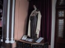
lim2005-042
|
(Thursday 4 August) Image of King John, King John's Castle |
 |
lim2005-043
|
(Thursday 4 August) King John's Castle, Nicholas St. |
 |
lim2005-044
|
(Thursday 4 August) King John's Castle, Nicholas St. |
 |
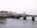
lim2005-045
|
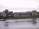
(Thursday 4 August) King John's Castle, viewed from the bridge over River Shannon |
 |
lim2005-046
|
(Thursday 4 August) King John's Castle, viewed from Clancy Rd. across River Shannon |
| |
|
|
| River Shannon |
|
|
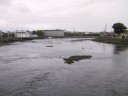 |
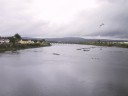
lim2005-050
|
(Thursday 4 August) River Shannon viewed from Tomond Bridge near King John's Castle |
 |
lim2005-051
|
(Thursday 4 August) River Shanon, viewed northward from Tomond Bridge near King John's Castle |
 |
lim2005-052
|
(Thursday 4 August) River Shannon, viewed northward from Tomond Bridge near King John's Castle |
 |
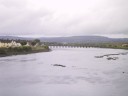
lim2005-053
|
(Thursday 4 August) River Shannon and Sarsfield Bridge, viewed southward from Clancy Rd. |
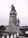 |
lim2005-054
|
(Thursday 4 August) A monument on Sarsfield Bridge over River Shannon |
| |
|
|
| Treaty Stone |
|
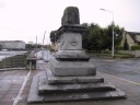
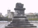
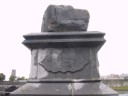
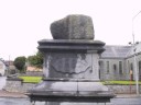
[CW; U 12.1380-81] Treaty Stone, Clancy Rd. In memory of the 1691 treaty in which the English king William III guaranteed the Catholics' freedom and status after Battle of Boyne in 1690 (the Limerick Treaty 1691). However, the English parliament never acknowledged the treaty and enacted the law of controlling the Irish Catholics: The English troops invaded the unarmed Ireland who believed the treaty. Thus the stone became the symbol of England's betrayal.
Joyce knew the treaty and this treaty stone very well: "Remember Limerick and the broken treatystone" (U12.1380-81). Cf. also "Ireland, Island of Saints and Sages," (1907, Critical Writings, pp. 168 &171; see above). |
 |
lim2005-055
|
(Thursday 4 August) [CW; U 12.1380-81] Treaty Stone, Clancy Rd |
 |
lim2005-058
|
(Thursday 4 August) [CW; U 12.1380-81] Treaty Stone, Clancy Rd. |
 |
lim2005-059
|
(Thursday 4 August) [CW; U 12.1380-81] Treaty Stone, Clancy Rd. |
 |
lim2005-060
|
(Thursday 4 August) [CW; U 12.1380-81] Treaty Stone, Clancy Rd. The pedestal of the stone was erected in May 1865 by Mayor John Rickard Tinsley. |
;)
;)
;)
;)
;)
;)
;)
;)
;)
;)
;)
;)
;)
;)
;)
;)
;)
;)
;)
;)
;)
;)
;)
;)
;)
;)
;)
;)
;)
;)
;)
;)
;)
;)
;)
;)
;)
;)
;)
;)
;)
;)
;)
;)
;)
;)
;)
;)
;)
;)
;)
;)
;)
;)
;)
;)
;)
;)
;)
;)
;)
;)
;)
;)